Research Background and Methodology
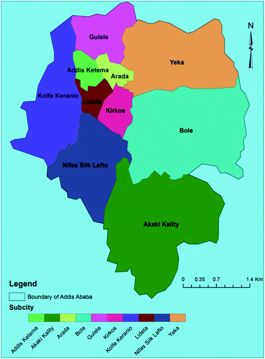
Fig. 1.1
Ethiopian regional map
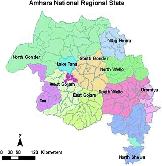
Fig. 1.2
The map of Amhara National Regional State

Fig. 1.3
The map of Addis Ababa City
a. Addis Ababa
Addis Ababa, the capital city of Ethiopia, was established by Emperor Menelik II in 1886. Addis Ababa is also the diplomatic centre of Africa which hosts 30 % of the urban population and is one of the fastest growing cities on the continent. Based on the 2007 population and housing census, the 2012 projected population figure of the city is 3.04 million.28 The city has been expanded from 22,360 ha in 1984 to 54,000 in 2010. Currently it is divided into 10 sub-cities (alternatively see map).29 The land in the city is classified into three zones according to its proximity to the center: namely, central market zone, transitional zone, and expansion zone. Of the total land area, about 14,765 ha is slum area destined for redevelopment.30
The main reasons for land expropriation in the city are urban renewal/redevelopment, construction of condominium housing, and road construction. Land that is significantly subjected to expropriation is located in the center and the expansion zones of the city. Land expropriated in the city center is used for urban renewal, road and railway construction, private investment, construction of government offices and the like. Land expropriation in the expansion zone (the periphery) is used mainly for housing (condominium, private, and real estate) and investment (industry). Private housing includes land replacements for those who are relocated from the city center by expropriation. In the transition zone, found in between the center and the expansion, the rate of land expropriation is lower, and if any, it is used for roads and private investments, such as hotels.
Urban renewal and upgrading activities are being done in the slum areas of the city center, such as Arada, Kirkos, Lideta and Addis Ketema sub-cities. Most of the houses in these areas belonged to the government since they were nationalized by the Derg in 1975. Yet, there were significant number of private houses in the middle of them as well.
The area selected for case study in Addis Ababa is the “Basha Wolde Chilot” in Arada sub-city. The Arada sub-city is one of the most blight areas which has been highly affected by expropriation and urban redevelopment processes. The Basha Wolde Chilot, literally translated as the “Court of Basha Wolde”, is found within the heart of the Arada sub-city. This area was built in the late nineteenth and early twentieth century, during the reign of emperor Menelik II, which means during the establishment of the city itself. Almost all the houses were slums made of mud and wood, without proper toilet and sewerage systems. Paradoxically, the front side of the Menelik Palace, which houses the prime minister, and the most prestigious Sheraton Hotel, have been surrounded by slum and low esteemed houses.
In this area as well, most houses were government owned although there were many private houses in the middle of them. Land accumulated by expropriating and demolishing the area is used basically for two things: the upfront is transferred by lease to private developers and business entities and the other part is used for condominium housing constructions.
Arada sub-city and especially Basha-Wold Chilot was selected as a case study for different reasons. The first reason is convenience. The study area is found at the heart of the city and is easily accessible to public transport and other offices such as the municipality and the city’s office for land bank. City officials who work at the municipality and the office of the city’s land bank were important subjects for the study not only because they were willing to be interviewed, but also for putting centrally collected data at the researcher’s disposal. Another reason for selecting Arada sub-city was because the sub-city has been involved in the expropriation of large sector of the city’s land, and hence it was believed that the built up experience would be beneficial to the researcher. A third reason is that it is believed that the Arada’s practice would be a typical one. This means the case of Basha-Wolde Chilot is similar in many respects with other areas which could have been included in the study. This is because the expropriation process is carried out based on the same law and most probably the practice would also be similar. For this reason, Basha-Wolde Chilot could be taken to be a representative of other similar expropriation actions within the city. The only shortcoming of this case is that it does not represent the expropriation of farmlands, since it is located in the city center. This is covered by selecting another case in the expansion zone.
The researcher held group discussions with the affected people to learn all the processes they had been passing through. The discussion also aimed at understanding their feelings with regard to the adequacy of the amount of compensation they received. The discussion was held in two groups: the first group included subjects who were freshly receiving compensation, and not condominiums or replacement lands; and the second group comprised those who have been displaced earlier and had received compensation and replacement land. In addition, senior and junior valuation experts in Arada sub-city and Yeka sub-city, which is the host kebele for the displaced people from Arada, were interviewed. Senior land-bank and land-development experts and officials were also approached to learn about the general plan, problems and developments in the city’s undertakings. The researcher was also allowed to review the documents containing the valuation figures.
b. Amhara Region
The Amhara National Regional State (ANRS) is the third biggest region in Ethiopia and covers a total land area of 170,152 km2. In terms of population, the region is home to 17.2 million inhabitants. About 89 % of the region’s people are rural farmers who are principally engaged in small-scale subsistence farming activities, while the remaining 11 % are urban dwellers engaged mainly in industry and services sectors. There are about 3.6 million rural properties in the Amhara Region employing more than 89 % of the region’s population. Three cases are considered from this region as described below.
Rib Irrigation Dam Project
The Rib Irrigation Dam Project is found in South Gondar Zone, Ebinat and Farta woredas, Amhara Regional State. The dam is being constructed on the Rib River, one of the tributaries of the Blue Nile River. The World Bank financed 100 million USD for the project, as part of the Nile Initiative Program. The Ethiopian government has allocated 10 million USD for the irrigation projects on top of the 100 million dollars soft loan extended by the Bank. The Rib dam will have a capacity to hold 234 million m3 of water. Upon going fully operational, the dam will develop 14,000 ha of land and benefit more than 28,000 households. The government believes that introducing the irrigation system creates permanent food security, helps soil conservation and increases food production. The Rib project which displaces 463 households, having a total of 1,672 family members, needs 306 ha of land. All the land under expropriation was used for crop production, tree plantation and grazing common lands.31
I visited the dam area in November 2012 and interviewed 45 people who lost their land for the construction of the dam site. It was not possible to involve other people in the interview, because they were not yet displaced from their land. However, they would be moved soon since their land is needed for the reservoir, drainage and other similar construction purposes. In any case, since the basic expropriation and valuation procedure was one and the same, it was believed that the 45 sample interviewees were representative enough. I have also looked into the valuation of properties of all the affected farmers, moved or not moved, which is based on the same rule. Besides, detailed discussion in the form of interview was held with the senior valuation expert of the Amhara Region who is in charge of all the expropriation, valuation and compensation tasks.
Bahir Dar
Bahir Dar city is the capital of the Amhara National Regional State (ANRS) inhabiting about 230,000 people, and is located on the southern shore of Lake Tana, the largest lake in Ethiopia. The Blue Nile (Abay-as called in Ethiopia) starts to flow from Lake Tana. The expansion of Bahir Dar city highly relied on the expropriation of land from the nearby rural farmers. Equally, the city has also been expropriating slums within the city and carrying out urban redevelopment and renewal programs. The case study chosen from Bahir Dar is the Abay-River-bank neighborhood case.
In 2011, the city administration haphazardly removed 54 households who had settled on the eastern side of the city along the Abay River and relocated them to the outskirt of the city. The land was needed for the construction of the office of the governor, the regional council and a modern conference hall. The people in this area were poor and lived in small and deteriorated houses. Most of the women in this neighborhood had been earning their income from small, home based, businesses such as selling Tella, a traditional beer. The other source of income for the women was the processing of lentil, bean and peas for the local grain stores. I have managed to conduct group discussion with randomly selected men and women heads of families and community leaders of the area, between January and February 2013. Moreover, a group discussion with three valuation experts at the Bahir Dar City municipality was held to get insight into the procedures followed. Further, municipal judges were also asked about the process so as to understand their version.
Road Construction Cases
The Ethiopian government has adopted a 5 years (2010/11–2014/15) Growth and Transformation Plan (GTP), which among others includes, the construction of 71,000 km rural roads all over Ethiopia.32 The 5 years’ plan of the Amhara region in this regard is to build 18,000 km of rural gravel roads having 4–10 m width. This program is known as Universal Rural Roads Access Program (URRAP). The construction of the roads also needs additional land for ditches and shoulders which extends the required land to 30 m in width. In the year 2011/12 only, the authority built 2,280 km of rural gravel roads across the region.33 The basic characteristic of rural roads construction in the Amhara region is that compensation is not paid for the land taken from farmers.
To investigate the practice in this sector, three woredas from the region were selected. The three road projects are found in Qunzila (28 km), Fagita (19 km), and Denbecha (31 km) woredas. These cases were proposed for the study by experts from the Regional Rural Roads Authority since they were about to be completed and involved the acquisition of large size of land.
I have visited part of the roads construction and able to hold group discussion with affected farmers. Besides, responsible officials of the Rural Roads Authority and the woreda administration heads of the three woredas were interviewed in different dates between September and December 2012. The gist of the interview was, as shall be discussed in detail, to get an idea as to why the government refused compensation for the land expropriated for the roads construction.
c. Oromia Region: Tulu Kapi Case
The Oromia National Regional State is the largest region in Ethiopia in terms of population size and area coverage. It is rich in natural resource and coffee production. I was interested in one peculiar case in this region. The case involves a mining project found in the West Wellega Zone of the Oromia Region. This mining project is known by its local name, Tulu Kapi Gold Mining Project. The Tulu Kapi Gold mining project belongs to Nyota Gold Mining with its headquarter in London.
The Tulu Kapi Gold Mining project rests on 11.3 ha of land and has affected 485 heads of family. All the farmers were engaged in both crop production and coffee plantation. Because of the toxic nature of the project, every person would be relocated and every house and religious site should be demolished. Unlike other public or private investments, this gold mining project has a World Bank’s stake in the business. The World Bank, through its private sector arm (IFC) involves in private projects that are considered by the Bank as robust ones. The Bank’s involvement creates additional obligation on the company concerning, among others, compensation and resettlement programs during land acquisition. Therefore, Nyota was considering additional packages of compensations and resettlement programs in addition to what is stated in the Ethiopian expropriation and compensation legislations.
As shall be seen in due course, this same rule was also followed by another international mining company in the Afar region in Ethiopia. This company which is known as Allana Potash is interested in the extraction and export of potash and again the World Bank has a stake in it. Allana Potash is a Canadian Mining company, which is currently about to start the extraction of potash from the Dallol area of the Afar Regional State in Ethiopia.
I visited the Tulu Kapi area during September 24–27 of 2012. During this time, there was a workshop taking place in Nekemt, the capital of West Wolega Zone, in which the mining company, regional, zonal, and woreda land administration offices, zonal and woreda administrations, the Ministry of Mining, judges and other stakeholders participated. Most of the data concerning the project was collected during this time. But additional interview was also held with woreda administrators and the region’s senior valuator. Besides, the researcher was given further information from the company concerning its obligations under the IFC land acquisition and resettlement rules.34
1.2.2 Legal Research Method
A legal research may be either doctrinal or non doctrinal. Doctrinal research is also known as legal dogmatic in the continental legal system. Doctrinal or legal dogmatic research can be defined in simple terms as research which asks what the law is in a particular area.35 Legal dogmatic research concerns with researching current positive law as laid down in written and unwritten (inter)national rules, principles, concepts, doctrines, case law and annotations in the literature.36 Its sources are predominantly those that are “thrown up by the legal process: principally statutes and decided cases, supplemented where possible with lawyers’ literature expounding the rule and occasionally reflecting on them.”37 This current positive law needs to be “treated” within its own limits—often described from an internal perspective—meaning that its own sources are used as a basis for study, description, explanation and analysis into (conflicting) underlying values, presuppositions and principles, as well as for criticism and any needed proposals for improvement.38 All this primarily serves judicial practice, although proposals for improvement are also addressed to legislators or policy-makers.
Non doctrinal legal research includes those researches which are based on problem, policy or law reform.39 Problem, policy and law reform research often includes a consideration of the social factors involved and/or the social impact of current law and practice. In this regard, the type of research done is descriptive or evaluative and its main task is to provide a recommendation for legal or policy reform or an amendment of the existing laws and procedures. The type of research done might include surveys and interviews with various individuals and groups affected. Such research is often referred to as socio-legal research.
These broad categories of legal research, which are grouped into doctrinal legal research and non-doctrinal legal research, obviously are not mutually exclusive. They overlap each other. In fact, all four categories of research, doctrinal, problem, policy and law reform could be part of a large scale research project. A researcher, for example, could begin by determining the existing law in a particular area (doctrinal). This may then be followed by a consideration of the problems currently affecting the law and the policy underpinning the existing law, highlighting, for example, the flaws in such policy. This in turn may lead the researcher to propose changes to the law (law reform).
While the doctrinal component of the above example could be seen as non-empirical, the assessment of the problem, evaluation of the policy and the need for law reform would require an empirical approach which could be quantitative, qualitative or a combination of the two.40